Forum Highlight
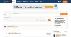
- RPLS is an online community for land surveyors, geomatics professionals, surveying students, and industry specialists to discuss technical challenges, share professional knowledge, and connect with others in the surveying field.
RPLS, also known as the Online Resource for Land Surveyors, is a long-running professional community serving the land surveying industry. Established in 1996, the platform brings together licensed surveyors, field crews, CAD technicians, students, educators, and other professionals connected to surveying. Its forums provide a place to exchange practical experience, ask technical questions, discuss industry developments, and learn from people working in different areas of the profession.
The forum covers a broad range of surveying and geospatial topics. Its main sections include Strictly Surveying, Software, CAD & Mapping, GNSS & Geodesy, 3D Laser Scanning & BIM, Photogrammetry, LiDAR & UAS, Business, Finance & Legal, and Education & Training. Members discuss everything from boundary and property line questions to GPS equipment, coordinate systems, mapping software, field-to-finish workflows, surveying regulations, and professional licensing. There is also an Ask a Surveyor section where property owners and other visitors can seek guidance on surveying-related questions.
Beyond technical discussions, RPLS offers resources that support the professional side of land surveying. Its marketplace includes classified listings for surveying instruments, software, and equipment, along with wanted listings and surveying job opportunities. Members can also use the Find a Surveyor directory to connect with licensed professionals by location and specialty. Additional areas cover member introductions, site announcements, industry news, and discussions among members. With an extensive archive of professional conversations, RPLS serves as a useful knowledge-sharing space for both experienced surveyors and people entering the field.
- Forum Software
- WordPress